So often, we tend to think of "natural history" in terms of the arguably more traditional definition of nature, specifically as the
world surrounding humankind but
existing independently of or uninfluenced by human activities.Certainly, this is a major part of natural history (the history outside of our own species), but it's so important to also include the history that involves our coexistence with and stewardship of the natural world.
 |
| 2012 © Sara J. Call |
Which brings me to The Big Ditch. There is a large canal that begins at the corner of Lake Como and stretches up past Stevensville to the bench lands southeast of Florence, delivering water to agricultural land (over 1,300 users) along a span of 75 miles. It is 25 feet across at the Lake, and gradually dwindles to a third that size before petering out to transect ditches completely.
 |
| 2012 © Sara J. Call |
If you grew up in agricultural land as I did, you know that even though water only fills canals and ditches for a few months out of the year, they create a significant amount of riparian-type habitat. And even though they go in relatively straight lines and don't meander like streams and creeks we like to picnic alongside, they are home to many of the same creatures we know and love near other waterways.

The Big Ditch (more formally known as the Bitter Root Main Canal) has an impressive history. Copper King Marcus Daly first conceived of a giant canal when he moved to the Bitter Root Valley and founded Hamilton in 1887. He built a few irrigation projects in the area, but his plans for a "big ditch" along the length of the entire valley were ended by his death in 1900. That same year, though, an intrepid business man named Samuel Dinsmore joined the irrigation game, and made plans to build a pipeline and canal that took water from the west fork of the Bitterroot River and ran parallel the river to Hamilton. After a few years, when finances ran low, he attracted wealthy investors from Chicago to finance his project, and it was then he founded the Bitter Root Irrigation Company and added the plan to take water from a storage-worthy fortified Lake Como. The scheme included the grand idea to buy up cheap land, bring irrigation water to it all, and resell hundreds of "orchard plots" to out-of-towners for a hefty profit. So, the "Apple Boom" of Western Montana was launched into full gear. Hundreds of speculative land buyers came to partake in the supposed fruit cornucopia of the Bitterroot Valley. The Big Ditch was dug with massive
steam shovels and communities were constructed, and the since-burned lavishly glamorous Bitter Root Inn was built. The promotional scheme seemed to be working.
But farmers found they could not afford to pay for water rights, and the land was not as perfectly suited for McIntosh apples as advertised. By 1917, the Bitter Root Valley Irrigation Company went bankrupt, and finally in 1920 the company became a municipal corporation run by the farmers that remained to raise livestock, vegetables, and wheat. Only a few orchards remain.
 |
2012 © Sara J. Call
|
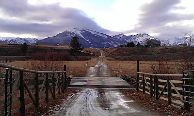
But the ditch remains. There is no sign or historical plaque marking it. It is still fully operational. And it is impressive; from Lake Como, it is sent up on to a bench on the west edge of the valley, then, a few miles later, it goes into a massive pipe, off a steep hillside, and disappears under Highway 93. It reappears on the other side of the pavement and crosses over the Bitterroot River, where it threads across the valley and weaves along the bench lands paralleling the river along the Selway Range.
 |
| 2012 © Sara J. Call |
I managed to follow it and intersect the ditch every so often along its length. I took unpaved residential roads, followed the Skalkaho Pass road, got lost in rural neighborhoods following transect ditches up to their origins, and found myself amazed at the immensity--and beauty--of the irrigation project.
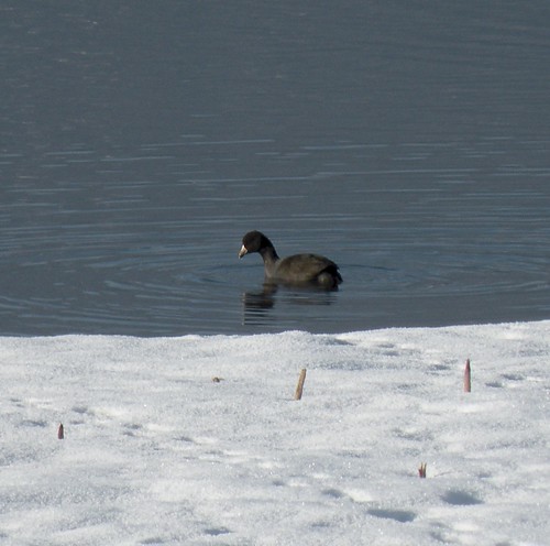
While out on a side road that I had successfully found crossed the Big Ditch, I paused to take a photograph at a sweeping bend of the canal that held some water from both snow melt and a dripping pipe that funneled a creek across near the bridge. I was stunned when I heard the following sound, and then saw its creator:
 |
| 2012 © Sara J. Call |
Yes, that's right; the red-winged blackbirds are beginning to return; spring is imminent! (I believe the one I heard and saw was a bachelor or yearling red-winged blackbird, recognizable by its muted or orange shoulder patches. These young guys return to gather in bachelor flocks rather than stake out territory like older males. He was smaller and up in a tree, not down near an obvious nesting site along the canal.)
All in all, what a magnificent adventure. And what a wonderful reminder that our cultural history remains so intertwined with that of the natural world, that even the things that many may believe are a threat to the natural world (ie: agriculture) also (or rather) provide habitat for the creatures with which we coexist.
As the sun set in the Bitterroot Valley, and as I paralleled the last leg of the tapering Big Ditch, I saw a group of white-tailed deer pause in a dry grass-filled pasture. The clouds were painted pink in the sky above them, and for a moment they looked curiously toward me before lifting their fluffy tails and bounding away toward higher ground. Below us, the lights of the city of Stevensville twinkled. The Bitterroot Valley held so many lovely surprises.
 |
| 2012 © Sara J. Call |
For further information: