Showing posts with label History. Show all posts

25 January 2013

Friday Field Notes: Why is Yellowstone in Montana?

Note: After more than a month-long hiatus in which the blog's author traveled to places as far and exotic as the Galapagos Islands and New Jersey, Friday Field Notes is back! Here's hoping that the natural world provides us all with excitement, beauty, enlightenment, and inspiration in 2013!

In the last few years, you may have driven past a billboard or a truck displaying this eye-catching advertisement:


The ad, containing a stunning aerial shot of Yellowstone's Grand Prismatic Spring, was put out by the Montana Office of Tourism in an attempt to ensure people spend time in Big Sky country on their next Yellowstone trip. The irony of it, however, will not be lost on most: Grand Prismatic rests firmly within Wyoming's borders. 

Yellowstone, oft heralded not just as America's but the world's first national park, is a spectacular and sublime place, so it's no surprise that Montana would want to claim partial "ownership" of it. And technically speaking, 3% of Yellowstone's more than 2.2 million acres is within our borders (1% falls within Idaho, while the remaining 96% makes up the northwest corner of Wyoming). But that's just the thing: only 3% of Yellowstone is within Montana. When one looks at the park's boundaries, this section appears as little more than a straight sliver of land invading south-central Montana. This observation begs the question: Just why exactly is Yellowstone even in Montana? A deeper look at history begins to reveal some of the answers.

27 February 2012

Bitterroot Valley surprises.

So often, we tend to think of "natural history" in terms of the arguably more traditional definition of nature, specifically as the world surrounding humankind but existing independently of or uninfluenced by human activities.Certainly, this is a major part of natural history (the history outside of our own species), but it's so important to also include the history that involves our coexistence with and stewardship of the natural world.
2012 © Sara J. Call
Which brings me to The Big Ditch. There is a large canal that begins at the corner of Lake Como and stretches up past Stevensville to the bench lands southeast of Florence, delivering water to agricultural land (over 1,300 users) along a span of 75 miles. It is 25 feet across at the Lake, and gradually dwindles to a third that size before petering out to transect ditches completely. 

2012 © Sara J. Call
2012 © Sara J. Call
If you grew up in agricultural land as I did, you know that even though water only fills canals and ditches for a few months out of the year, they create a significant amount of riparian-type habitat. And even though they go in relatively straight lines and don't meander like streams and creeks we like to picnic alongside, they are home to many of the same creatures we know and love near other waterways. 

The Big Ditch (more formally known as the Bitter Root Main Canal) has an impressive history. Copper King Marcus Daly first conceived of a giant canal when he moved to the Bitter Root Valley and founded Hamilton in 1887. He built a few irrigation projects in the area, but his plans for a "big ditch" along the length of the entire valley were ended by his death in 1900. That same year, though, an intrepid business man named Samuel Dinsmore joined the irrigation game, and made plans to build a pipeline and canal that took water from the west fork of the Bitterroot River and ran parallel the river to Hamilton. After a few years, when finances ran low, he attracted wealthy investors from Chicago to finance his project, and it was then he founded the Bitter Root Irrigation Company and added the plan to take water from a storage-worthy fortified Lake Como. The scheme included the grand idea to buy up cheap land, bring irrigation water to it all, and resell hundreds of "orchard plots" to out-of-towners for a hefty profit. So, the "Apple Boom" of Western Montana was launched into full gear. Hundreds of speculative land buyers came to partake in the supposed fruit cornucopia of the Bitterroot Valley. The Big Ditch was dug with massive steam shovels and communities were constructed, and the since-burned lavishly glamorous Bitter Root Inn was built. The promotional scheme seemed to be working.

But farmers found they could not afford to pay for water rights, and the land was not as perfectly suited for McIntosh apples as advertised. By 1917, the Bitter Root Valley Irrigation Company went bankrupt, and finally in 1920 the company became a municipal corporation run by the farmers that remained to raise livestock, vegetables, and wheat. Only a few orchards remain. 
2012 © Sara J. Call

But the ditch remains. There is no sign or historical plaque marking it. It is still fully operational. And it is impressive; from Lake Como, it is sent up on to a bench on the west edge of the valley, then, a few miles later, it goes into a massive pipe, off a steep hillside, and disappears under Highway 93. It reappears on the other side of the pavement and crosses over the Bitterroot River, where it threads across the valley and weaves along the bench lands paralleling the river along the Selway Range. 

2012 © Sara J. Call

I managed to follow it and intersect the ditch every so often along its length. I took unpaved residential roads, followed the Skalkaho Pass road, got lost in rural neighborhoods following transect ditches up to their origins, and found myself amazed at the immensity--and beauty--of the irrigation project.    


While out on a side road that I had successfully found crossed the Big Ditch, I paused to take a photograph at a sweeping bend of the canal that held some water from both snow melt and a dripping pipe that funneled a creek across near the bridge. I was stunned when I heard the following sound, and then saw its creator:
2012 © Sara J. Call


Yes, that's right; the red-winged blackbirds are beginning to return; spring is imminent! (I believe the one I heard and saw was a bachelor or yearling red-winged blackbird, recognizable by its muted or orange shoulder patches. These young guys return to gather in bachelor flocks rather than stake out territory like older males. He was smaller and up in a tree, not down near an obvious nesting site along the canal.)

All in all, what a magnificent adventure. And what a wonderful reminder that our cultural history remains so intertwined with that of the natural world, that even the things that many may believe are a threat to the natural world (ie: agriculture) also (or rather) provide habitat for the creatures with which we coexist.

As the sun set in the Bitterroot Valley, and as I paralleled the last leg of the tapering Big Ditch, I saw a group of white-tailed deer pause in a dry grass-filled pasture. The clouds were painted pink in the sky above them, and for a moment they looked curiously toward me before lifting their fluffy tails and bounding away toward higher ground. Below us, the lights of the city of Stevensville twinkled. The Bitterroot Valley held so many lovely surprises.   
2012 © Sara J. Call


For further information:

23 February 2012

February in the Bitterroot.

Nearly a month ago, Bitterroot Bill (the yellow-bellied marmot, cousin to groundhog Punxsutawney Phil) predicted the imminence of spring--or, more accurately, he didn't show himself at all on the overcast Groundhog Day at the Lee Metcalf National Wildlife Refuge. That may be hard to believe with all the winter storm warnings we have been getting, but we can always hope.
© Sara J. Call 2012
There's quite a bit less snow in the Bitterroot Valley, and quite a bit more sun. I drive out there every so often to get out from under the grey skies that have been frequenting Missoula Valley as of late. Even when the sky is overcast in the Bitterroot, it will open up to let rays of sun burst through, which is always wonderful. Last week, I drove down through Stevensville and took a loop through the Lee Metcalf Refuge to catch those rays of sunlight. There's a surprising amount of bird-watching to be had along the ponds, even now. Before long, I'm sure one will be able to spot a muskrat or two patrolling the thawing waterways.
© Sara J. Call 2012


Briefly, some interesting history about Lee Metcalf National Wildlife Refuge: it was founded in 1963 and renamed to 'Lee Metcalf' in 1978 in honor of the late senator that helped establish conservation projects across the state of Montana. The refuge is a total of 2,800 acres. Natural trails wind through 160 acres of ponds, sloughs, and river bottoms. While it predominately caters to providing habitat for migratory birds, the refuge also contains plenty of other creatures: beavers, muskrats, osprey, and yellow-bellied marmots, to name a few. Fish are also protected residents. The habitat is actively managed, meaning that people control water levels using siphons and pumps; provide weed control using fire, mechanical means, and sometimes cattle; and allow sportsman to come birding during hunting season. All of the management techniques are necessary to help maintain healthy wetlands and riparian areas in the refuge, where the riparian zones are human-enhanced and dependent on periodic drawdowns.


The Bitterroot Range provides a wondrous backdrop to the wetlands. I saw dozens of ducks (mallards and others) and Canada geese, and watched an American coot dabbling near the shoreline, tipping forward and bobbing with tail pointing skyward for a few moments before settling back upright on the water to swallow whatever he had found to eat. 

© Sara J. Call 2012

© USFWS Mountain Prairie


A great blue heron stood reflected in a small pond as the sun set, and the clouds were splashed with an amazing array of pink and purple that we rarely see in Missoula skies. Before I could document the moment in a photo, the heron hunched his lanky frame and lifted away into the dusk, scattering droplets of water like beads.

 In the coming months, the red-winged and yellow-headed blackbirds will return, which is my favorite time of spring. You can definitely bet on good birdwatching at Lee Metcalf NWR, year-round. 


See our spring post on the birds of Lee Metcalf from last year here.

REFERENCES:
"Get Ready For Spring" - NBC Montana, 2 Feb 2012
"Lee Metcalf Refuge Revitalizes Pond with Fire, Cattle" - 4 Nov 2011
Montana Birding Trail - Lee Metcalf NWR
USFWS Lee Metcalf National Wildlife Refuge website
Wikipedia entry

26 January 2012

The Adel Mountains: Volcanic Pile

With over forty individually-named but unofficially delineated mountain ranges, Montana (from the Spanish word for mountain, montaƱa) is aptly named. The Rocky Mountain front cleaves down the northwestern portion of Montana, paralleling the Bitterroot, Flathead, Swan, Salish, and Mission Mountain ranges, while in the southwestern part of the state, the ranges are less of linear striations than variegated and somewhat disjointed bands of ridges jutting up like islands in the prairie.

http://images.summitpost.org/original/444328.jpg
Everyone in Montana, it would seem, recognizes the impressive Crazy Mountains; recreationalists love them for their plentiful alpine lakes, good fishing, and beautiful camping opportunities, and ranchers love them for the sweet grass they tower over. But nearby, a less known mountain range sits sentinel over a volcanic pile to the northwest.
2012 © Sara J. Call
If you have ever driven on I-15 from Great Falls to Helena (or vice versa), you may remember that you pass a sign identifying the Big Belt Mountains along the highway just past Cascade. The peaks rise impressively above, and if you continue on the highway , you will drop into a section of the Missouri River canyon to the northwest of the larger peaks. The interstate crosses the river, where log cabins have been built alongside the slow moving river. You may see a historic landmark sign that tells the story of the St. Peter’s Mission, made especially famous by Mary Fields, an emancipated slave who came to live with her former owner’s daughter, a nun that had helped establish the Mission. Mary’s strength and size came in handy in the repair of the mission’s dilapidated buildings, and she became the construction foreman; but when one of the workman who resented her struck her and reached for his pistol, she fired her six-shooter at him and was asked to leave the Mission. In 1895 when she was 60 years old, she was hired as a U.S. mail coach driver in Cascade and became known as the legendary Stagecoach Mary.
http://www.blackcowboys.com/maryfields.htm

 Continuing past St. Peter’s Mission, the interstate meanders through dark columnar igneous rock. While this range is adjacent to the Big Belt Mountain range, it is a separate range referred to as the Adel Mountains Volcanic Field.
Both the Little and the Big Belt mountains are not necessarily impressive in the same ways as other more popular mountain ranges in Montana; they are tall, and therefore a large portion of the peaks are above timberline, but they are also not heavily forested in general and are notably more rounded. There is not exceptionally good fishing or camping available, and only one part of the mountain range, the Gates of the Mountains, is designated wilderness. The area is forest service land, and popular for off-roading and horse-packing. The adjoining Adel Mountains (eroded to be no longer a recognizable volcanic cone) provide even less recreational opportunity, being a 40 mile long by 20 mile wide swath of almost vertical volcanic rock; but they possess a fascinating and uncommon geologic history.

Rod Benson © http://formontana.net/hardy.html
http://formontana.net/hardy.html
More than a billion years ago, two continental plates collided and formed what we call the Great Falls Tectonic Zone, a crustal weakness that lead to the volcanic creation of a series of mountains and buttes in the area and, most recently (around 75 million years ago), allowed magma to well up and create the Adel Mountains over top the surrounding sedimentary rock.

The Adel Mountain Volcanic Field is made of a rare type of intrusive igneous rock known as shonkinite, which is found only in Montana, British Columbia, Ontario, and the Indonesian island of Timor. It’s similar to basalt but more brittle, and principally contains augite and a type of feldspar.

From the interstate, you can see multiple dikes that radiate from the center of the formation zone; from within the canyon, the dikes are dark, vertical ridges (hint: look left at milepost 247 and right at milepost 250). These dikes often were the path magma followed to form laccoliths, which are intrusions of magma between layers of sedimentary rock that forced upper strata of rock upwards to form domes or buttes. Shaw Butte, Cascade Butte, and Square Butte were all formed in this way, and Square Butte has eroded enough to expose the actual laccolith volcanic formation within.

But you don’t need to be a historian or geologist to appreciate the Adel Mountains Volcanic Field. When I last drove through the area, the fresh layers of snow draped over the dark rock and sparkled like fish scales, and the wind picked up streams of shimmering snow and poured it over the edges of the cliffs like waterfalls. The snow crystals whirled around in the canyon and crashed against the raised road bed in the sunlight like a cold, white ocean wave, then snaked across the lanes of highway until dissipating like mist. It’s a magical area.


References:
http://www.bigskyfishing.com/Mountain-Fishing/belt_mountains.htm

http://www.cascademontana.com/mary.htm

https://docs.google.com/viewer?a=v&q=cache:8XO1-TvJs0QJ:mathscience.mt.gov/files/RoadSignPDF/Adel.pdf+&hl=en&gl=us&pid=bl&srcid=ADGEESh0lDMOJy2JJefzas4lHUc_H6eBTfZ-uxytmS7DKGQz3vl5QAAaB2u55h7R1xw2yx5uhUgLNMoSFR9hyD30XKALNUZLnKLEKzLTuigKlFTVh5d_tmO7fnp_0zY-4lukg1HmvlAc&sig=AHIEtbRRSLpC-pYQzaH3-To3SIbwOjZBIA

http://en.wikipedia.org/wiki/Adel_Mountains_Volcanic_Field

http://visitmt.com/categories/moreinfo.asp?SiteID=1&IDRRecordID=15520

Shonkinite
http://www.troutfishinglodgingmontana.com/gpage8.html


27 October 2011

Philipsburg Area

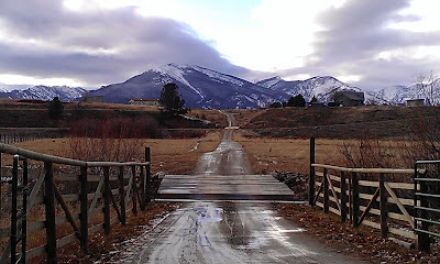
 Not much more than an hour outside of Missoula, you can escape to a little morsel of historical significance known as Philipsburg. It’s not too far along I-90 E, maybe 50 miles, after you wind past the forested areas of Beavertail and Bearmouth and emerge into a wide (and golden!) valley, that you turn off the interstate at Drummond and follow MT-1 S up the valley to the small town of less than a thousand.
At this time of year, the drive from Missoula to Drummond is spectacular with all the vibrant autumn colors--red maples, yellow larch, golden aspens--but the drive from Drummond to Philipsburg along the Pintar Scenic Route is phenomenal. I love slowing down and inspecting the ranches, looking at resting horses, wandering cattle, and ranchers leaning against the fence posts.

Philipsburg isn’t that big, but don’t let that deceive you into thinking that you could see it all from one place. I stayed two days and a night, and plan on going back because I didn’t see nearly everything that I wanted to (if you’re looking for a place to stay, I would recommend The Broadway Inn).

In town, there are numerous places to eat (Doe Brothers has stellar burgers and sweet potato fries) and a decidedly amazing candy store. The Sweet Palace is overwhelming! The fudge flavors are decadent and the truffles--oh, the truffles--are worth every bite. If you happen to get there when they are packaging salt water taffies and one of the taffies escapes unwrapped, they will give you it as a sample, and you will be struck with an inexplicable desire to buy more. Just a warning.

We went up to the cemetery on the hill and sought out the oldest headstones to get a sense of the beginnings of the city. There were so many sad stories contained in the collection of grave markings, stories of children lost over the years and all at once, fathers and mothers that died young or survived decades beyond their spouses and children, singular spouses left buried in the ground alone after their partners must have packed up all they had left and moved away.

We went on a wet weekend, but after the rain let up a little, we drove the narrow dirt road to Granite ghost town. It’s a road you’ll want a high clearance, 4WD vehicle for, but it’s worthwhile heading up there.
 

Photo courtesy of Montana Fish, Wildlife, and Parks | http://visitmt.com/pictures/big/5179h.jpg
It’s difficult to believe that 3,000 people once lived where a few ruins now cling to the mountainside. We wandered along the Granite Ghost Walk and sought out foundations, most of which were broken up by tree roots and frost weathering. It’s amazing to think that the buildings in this area were built by hand, from the huge stones set in near-perfect walls to brick arches to giant steel towers. It’s amazing to think that the trees and vegetation have filled in so much in the past hundred and some years.
 
Photo courtesy of Sara Call

  The mine’s remaining structure is possibly the most impressive part of the area. It is massive, and only partially crumbling. Mica-studded granite sparkled throughout the rubble, brightened by the recent drizzle. The view from the mine’s perch was beautiful. 
Photos courtesy of Sara Call
On our second day of exploring, we made an appointment with a volunteer at the Granite County Museum and Cultural Center. Esther, a spunky older lady with lots of knowledge and hard work behind her, chatted with us but didn’t prepare us for how much we would get for our $3 admission fee. The upstairs portion of the exhibit included models, clothing, saddles, and cattle brands from way back to the 1870’s. Photos and descriptions of local ghost towns lined the walls, and an extensive mineral and rock collection filled an entire corner of a room.

We made our way downstairs, and there sat all sorts of mining equipment and buildings models--the original sign from the general store, an assay office model, a miner’s cabin, and a massive lift (the original elevator) and hydraulic engine. The absolute most incredible part of the museum was the walk-in replica of a silver mine shaft, built by volunteers. It’s a wonderful piece of work.

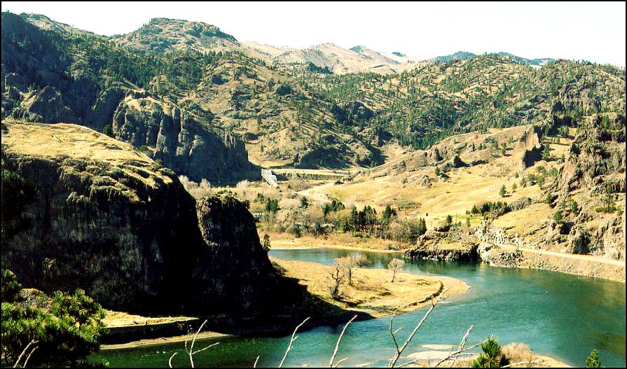
There are a few other ghost towns around Philipsburg that you can also visit--Kirkville and Garnet, for example--and plenty of recreational activities to engage in around the area. Over the pass to the southeast is Georgetown Lake, and if you continue down MT-1 S you’ll come into Anaconda, another town of significance in our state’s history of mining.

Of course, there’s also Drummond, which is a character-filled town in and of itself... If you’re there on a Saturday, check out the Used Cow Lot!


Sources and links:
http://visitmt.com/categories/moreinfo.asp?IDRRecordID=6737&siteid=1
http://philipsburgmt.com/museum
http://www.drummondmontana.com/SurroundingArea.html